
UK Demographic Mapping Data
Postcode Sector Demographics
Easily import into your GIS
Supplied in Shapefile format SHP
Other formats available
Over 80 Variables
Over 8,900 postcode sectors across England, Scotland and Wales included
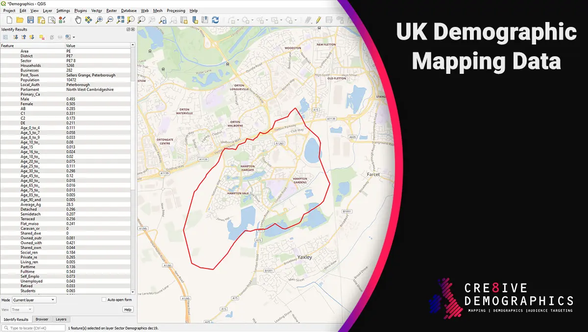
Our Data in Your Hands
Our UK demographic database covers over 8,900 postcode sectors in England Scotland and Wales with over 80 variables for each sector. This data can be imported into all leading GIS systems such as QGIS, Geoplan Skin, ArcGIS etc.
Our data is supplied as standard in shp format with the accompanying dbf and shx files. If another format is required please let us know.
Delivery of the data is within 12 hours of purchase.
Demographics Included
- Households
- Average House Price
- Businesses
- Post Town
- Average Household Size
- Population (estimate)
- Gender Split
- Social Status
- Age groups & Average Age
- Average Number of Bedrooms
- Property Type
- Tenure
- Employment Status
- Marital Status
- Household Occupants
- Ethnic Group
- Religion
- Disability
- Vehicles in Household
- Children in Household
Check to see our coverage
Use our search tool to see if the postcode sectors (i.e PE7 8) you are looking for are covered.
Demographic Mapping Data
£0.00 – £2,950.00Price range: £0.00 through £2,950.00 +vat
8,904
Demographics
8,056
Average House Price
10,568
Geometry Polygons
9,337
Household & Business Counts
| Licensing | Postcode Sector boundaries for mapping is licenced to be used by yourself or individuals within your company and is not to be sold on |
|---|---|
| Reference | Contains National Statistics data © Crown copyright and database right 20201 |
| Last Updated | January 2022 |